By Nayana Manjari Dasi
Day 1
El Chorro the road of the ancient Incas
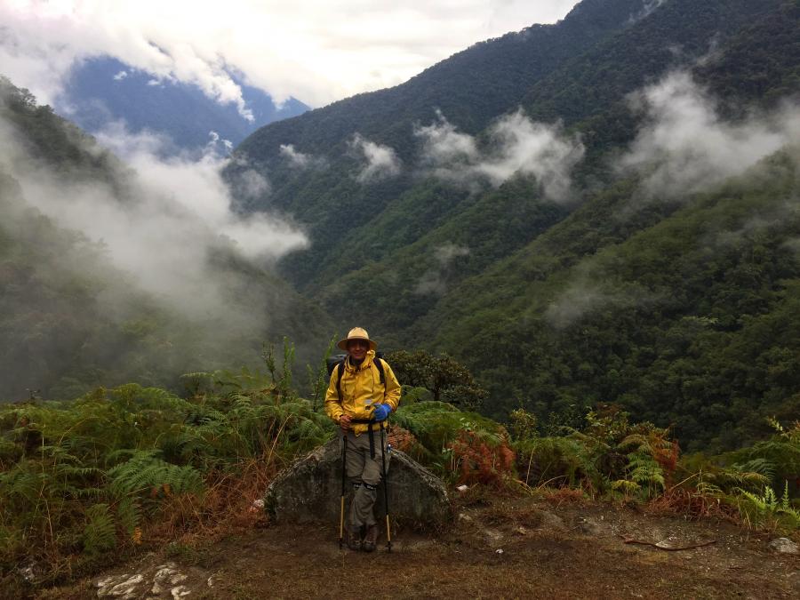
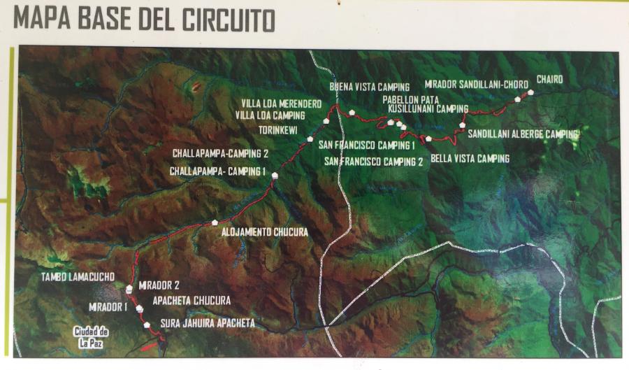
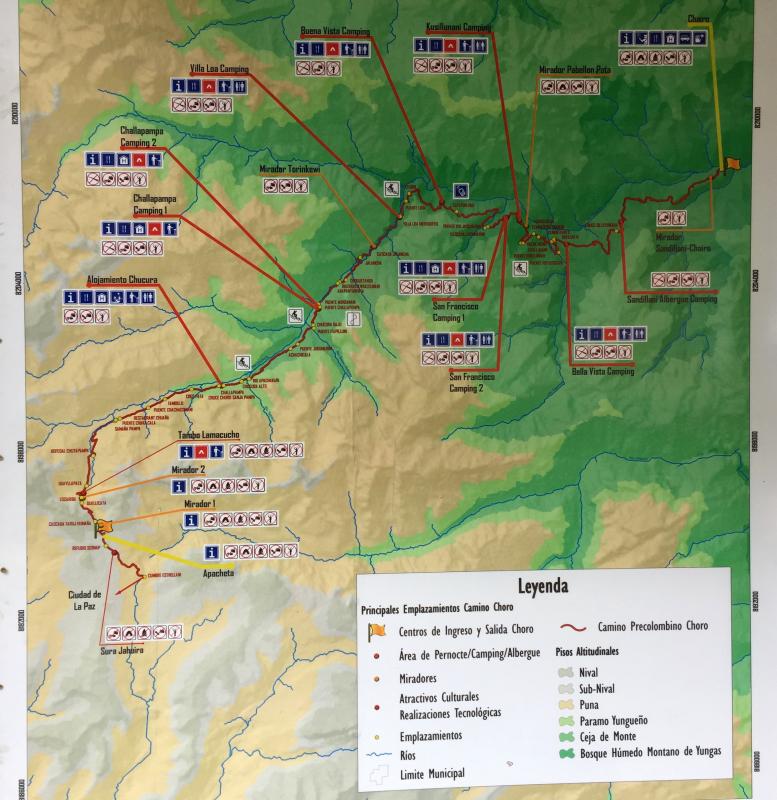
On a Friday, September 23rd our team embarked on a second padayatra in Bolivia in honour of ISKCON’s 50th anniversary. This time our route followed the ancient Inca roads found in the Andes Mountains. We walked for three-days along a road known as ‘El Chorro’ which starts in the mountains and ends in the rainforest 52 kilometres away. This road is between 500 and 1000 years old and was built by the Tiahuanaco (Tiwanku) people and sometime after it was improved upon and used by the Incas. Later, the Spanish conquerors used it and even up until recently it was used to connect the Bolivian highlands with the Amazon region. This road formed part of the Inca highway system known as the Qhapaq Nan (the Great Road) that spanned across six South American countries. Today it is recognized as a UNESCO[1] heritage site. The idea for this padayatra was to spread the holy names to the remote mountain villages of this area.
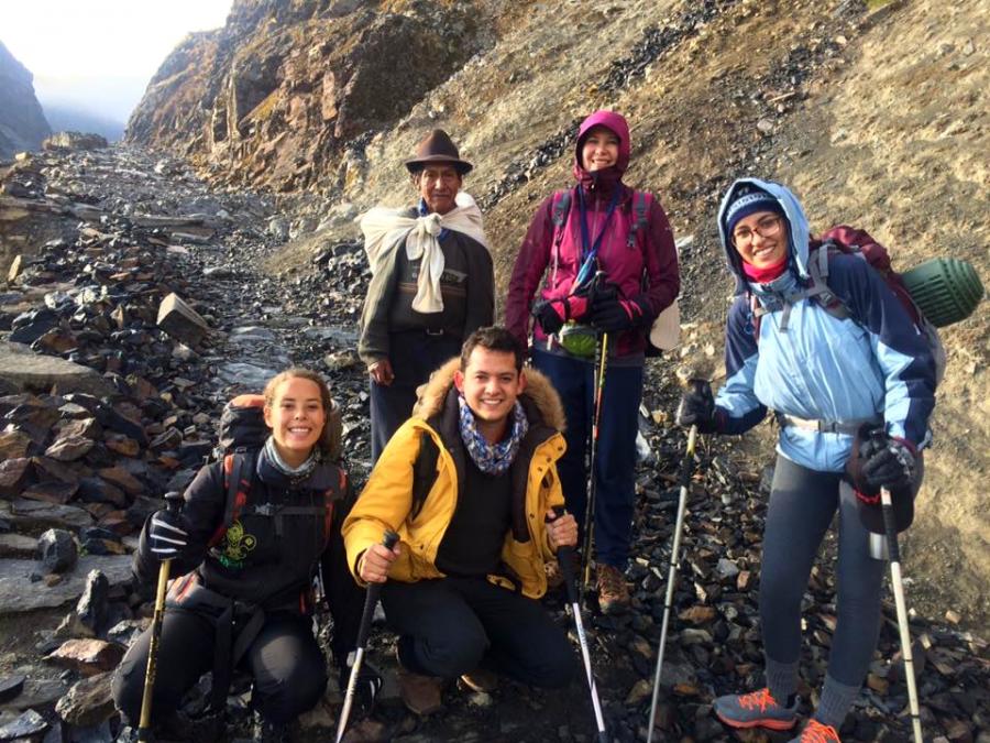
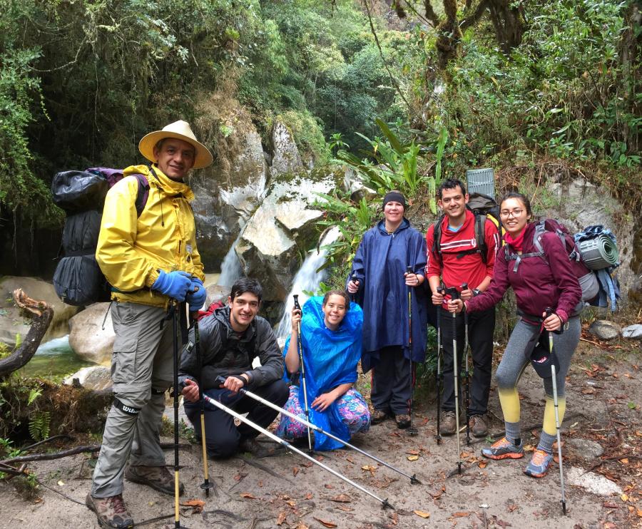
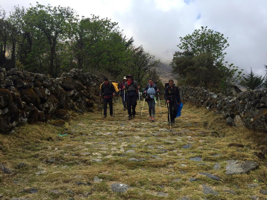
Our padayatra team was made up of six people, two grihastha matajis, three grihastha prabhus, and the teenage daughter of one of the grihastha couples. We were also accompanied by small Sri Sri Nitai Gaurasundar deities and a salagram sila. During the padayatra we carried the deities in a special pouch for safe keeping. We had to do this because there were parts of the trail that were very dangerous to negotiate. For the most part we needed both hands to balance as we walked, to prevent falling over the ledges.
There were some parts of the trail that were a mere foot wide with the mountain on one side and a sheer drop on the other. We also had to use walking sticks to help us walk more securely therefore, for our own safety and the deities’ safety we carried them in a pouch and only took them out after setting up camp.
Special offering to Sura Jahuira
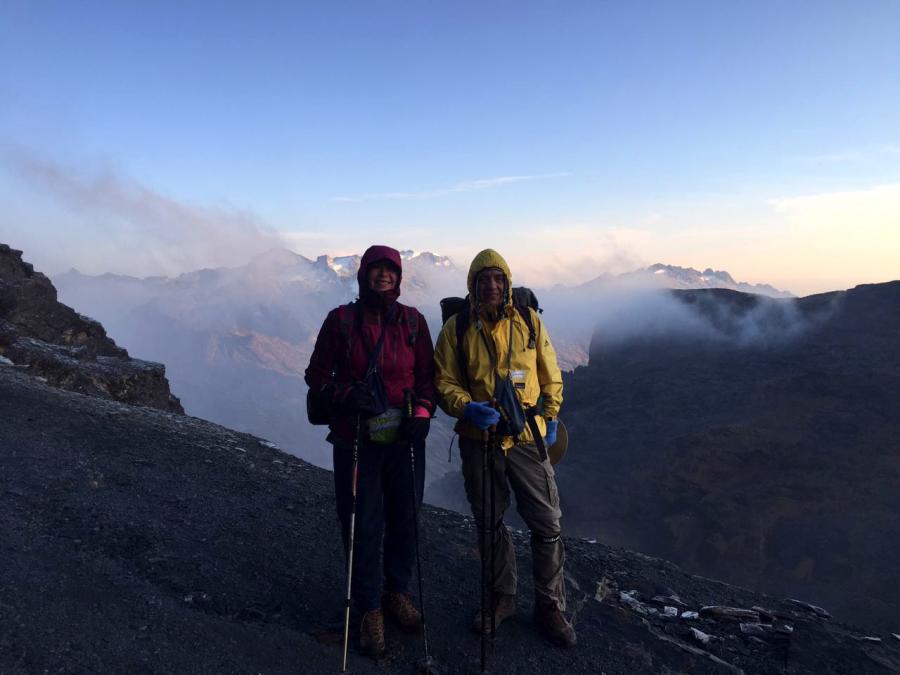
We departed that Friday morning at 5am from the city of La Paz in a minibus. The bus drove us 30 kilometres North-east of the city to the Cumbre Estrellani in the Cotapata National Park. When we arrived the sun was just rising and it was freezing and the stones on the path were covered with frost. We chanted the narasimha prayers, put on our backpacks and started the 3 kilometre uphill walk to the highest point of the mountain called the ‘Sura Jahuira Apacheta’. At 4900 meters above sea level, it was also the highest point of the padayatra. Once we reached the top we observed the local custom for travellers. For many centuries travellers would mark their passing here by placing a stone (which the person had carried from a lower elevation) on top of a pile of stones called the ‘Apacheta Chucura’ –thus making an offering to this sacred place. The ‘Apacheta Chucura’ can be likened to a stone cairn or a pile of rough stones built as a memorial or landmark. We had also brought a stone with us, but it was not a regular stone, it was a shalagram sila. We placed our shalagram sila named Lord Damodar on top of the stone-pile so that He could bless the mountain with His sacred touch.
We then headed downwards about an hour away from the ‘Apachera Chucura’ area to the remains of a ‘tambo’ or wayside inn[2] dating back to Incan times. We stopped here to have breakfast and rest before continuing. After travelling for an hour below the ‘tambo’ area we arrived at the hamlet of Samana Pampa where a grassy campsite was located. Our team decided to rest here for a while but before we could do so we had to register our names at a registration hut. The formality was required because a part of the road we were travelling on was in a national park
After having rested we walked on for another 6km to the village of Chucura. This part of the road was still very well preserved and the view of the mountains around us was spectacular. We even stumbled upon some small mountain streams where we bathed the shalagram shila in the pure water. As we made our descent we noticed that the landscape had started to change and the temperature had become warmer. We walked for another two hours along beautiful stretches of pre-Columbian paving stones until we reached another village called Challapampa at around 2:30pm. Our team set up camp aongside the river and promptly encountered the local mosquitoes. We took our Gaura Nitai deities to a nice spot and made a simple altar for them on a rock overlooking the river. We rested there for a while just appreciating the natural beauty of the place while chanting some japa. That evening we sung bhajans around the campfire, ate supper and rested thus completing our first day on padayatra.
Day 2
Slippery stones
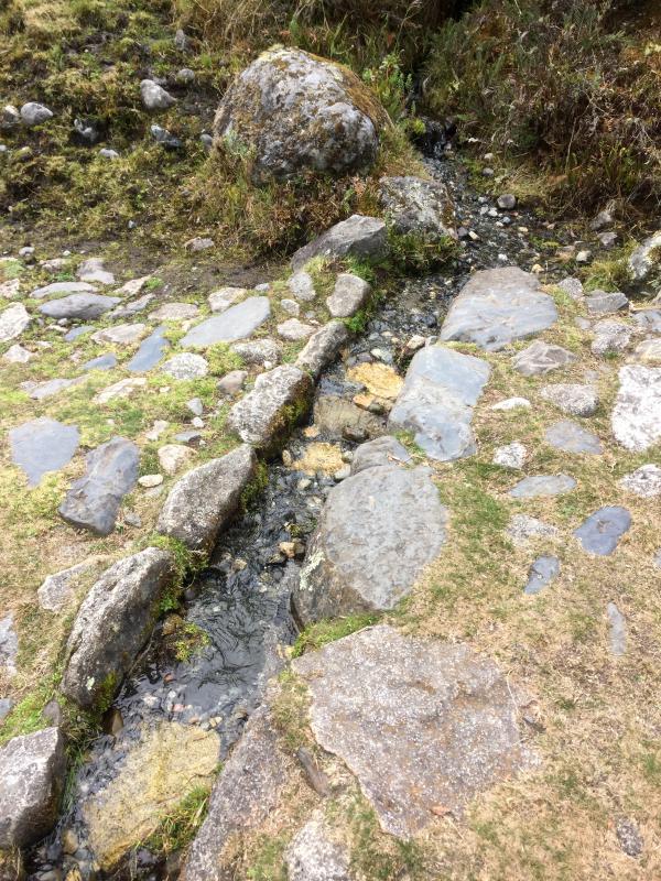
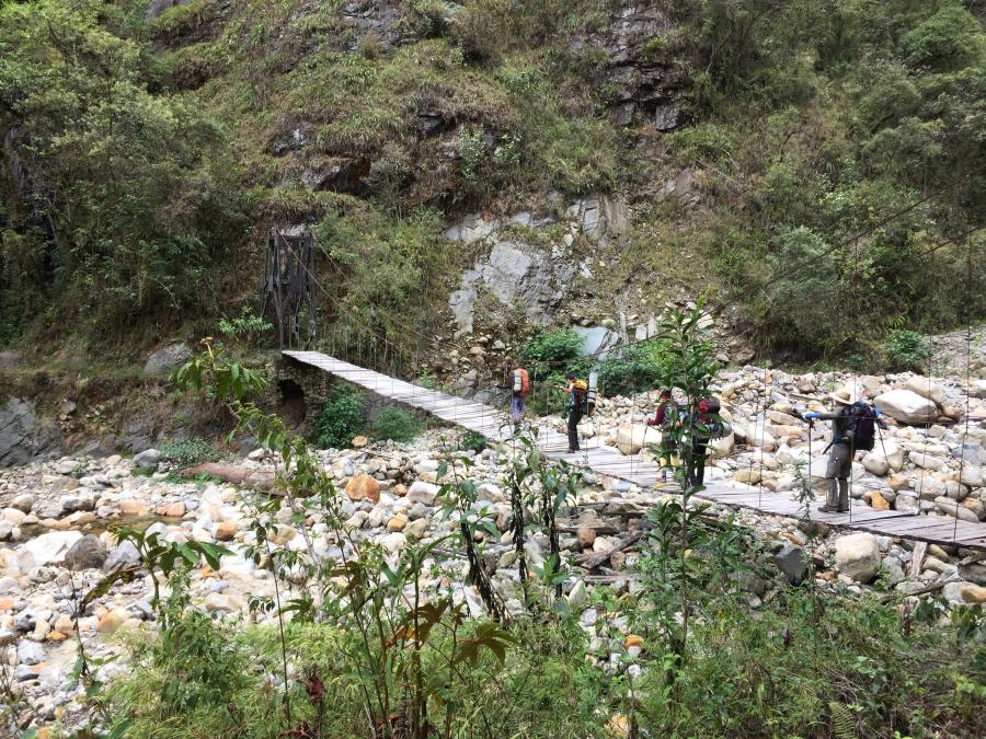
The next day, Saturday morning, we awoke, chanted our rounds and then sang the govinda and narasimha prayers to the Deities after which we placed them safely in Their travelling pouch. We then packed up our camp and departed as early as we could since it would take about eleven hours to get to our next campsite and we wanted to reach there before nightfall. The engineers who designed the road we were travelling on had made provision for all the little rivulets that flowed down from the mountain to be channelled across the road. This they did by incorporating canals into the road. However, in some places the water had changed course with the passing of time and the water now flowed over the road making the paving stones quite slippery. We walked cautiously over the paving stones and after about two hours we came across a suspension bridge at the village of El Chorro. The bridge spanned across the Chucura River and headed east along the right-hand side of a deep, densely forested valley. We decided to sit down on the grass and have our breakfast there.
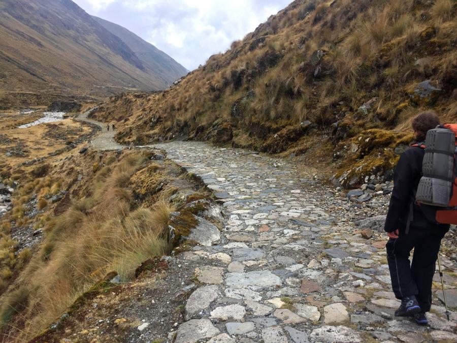
From here on the trail varied and for the most part it was a steady descent. We crossed streams and saw many waterfalls where we could refill our water bottles and also bathe Their Lordships. Sometimes we walked along the side of a mountain, and at other times we walked amidst the dense rain forest down in the valley. We saw that in some places the original paving stones were almost all gone, taken by the villagers to build their stone houses –and sometimes due to the passing of time they disappeared covered by grass, moss and leaves. In other places the road was majestic, broad and wide, with the paving stones in pristine condition, looking as if the road had just been recently built.
The Devil’s climb
We then forded the Jucumarini River and crossed the deep gorge of the Coscapa River on another somewhat rickety suspension bridge. In the rain forest birds were singing very loudly and there were many butterflies and colourful insects to be seen on the giant leaves of the forest vegetation. There were many camping sites along this route where one could set up camp, or just rest for a while. The first such camping site we arrived at was ‘San Fransisco’. We were so tired that we took off our backpacks and lay on the grass for a while. After a short rest, we ate a snack to boost our energy and continued to the next resting spot at ‘Buena Vista’. Little did we know though, that the ‘San Fransisco’ and ‘Buena Vista’ campsites are separated by a very stiff ascent and descent known as the Subida del Diablo (The devil’s climb). This was an absolutely apt name as we soon found out!
Subida del Diablo was a never-ending, winding climb up the side of the mountain. The trail which was cut into the mountain was very deceptive. We could only see one part of the steep zigzag, so we thought that once we reached the top it was over. Wrong! When we reached the top of that steep climb there was another very steep climb still ahead, and this continued for the better part of an hour. It was very easy to remember Krishna here, given that, in suffering it is easier to remember the Lord. It was a difficult climb, both physically and mentally.
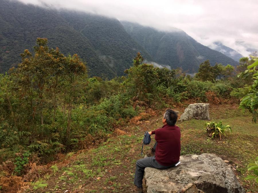
When we finally arrived in ‘Buena Vista’ we took a well deserved rest and ate. ‘Buena Vista’ certainly lived up to its name which means ‘good view’. There was a beautiful view of the valley below with green lawns, banana trees and lush green vegetation all around.
Incan staircase
After having rested we continued our descent until we came to another suspension bridge, which we crossed and entered deeper into the forest until we met the Jucumarini river again. We stopped there for a while to admire the view and to refill our water bottles from a waterfall that was plunging down from the top of the mountain to a ledge halfway down, where it formed a pool before falling down to ground level. Then another surprise – there was another major uphill climb! This climb consisted of giant stairs that were built by the Incas. Each stair was about 2 meters wide and 18cm high and they were very difficult to climb because we were already so tired. It took a lot of effort to climb up those stairs while wearing backpacks. It was an exercise in mind control to get to the top. The stairs were also built with the now familiar zigzag design we encountered in ‘The Devil’s climb’ so, we all took a couple of rest stops before we were finally able to reach the top.
We then continued walking for another three hours before reaching our campsite in Sandillani, in the early evening. The campsite had a lovely Japanese garden with a spectacular view of the surrounding mountains. We had just enough energy left after the hard day’s walk to set up camp and take bath, before we crawled into our sleeping bags to rest.
Day 3
The marvellous work of the Incas
We woke up bright and early on Sunday morning: our final day on padayatra. After bathing we chanted and then made an altar for their Lordships on a beautiful rock overlooking the valley and the mountains. There were many roses in the campsite gardens, so we plucked some to decorate the altar. We sung the mahamantra and the hari haraya nama krishna bhajan and ate breakfast afterwards. When we were done we packed our camp, sang another bhajan and departed from Sandillani at 10 am since it was only a two and a half-hour downhill walk to El Chairo, the village where the trail ends.
It was a pleasant downhill walk and we sang as we made our way through the forest. When we neared the end of the trail we saw some contention walls built by the Incas –we marvelled at their expertise. These walls help keep the road stable and it prevents people from falling off the road as it winds down the mountain. The particular part of the road we were travelling on had retained its original width in some places, and we understood that this was once a great highway. We also saw some amazing examples of terrace farming where the local farmers had planted maize on the sides of very steep mountains. Our jaws dropped in amazement, to even think that people could actually walk in that place, let alone farm there, was phenomenal. Then the landscape transformed from rainforest to grassland and we had our first glimpse of the Chorro River down below us. Our destination was in sight. We continued down one last mountain until we found ourselves in the middle of the El Chorro village around noon. We rested there until our bus picked us up and took us back to La Paz.
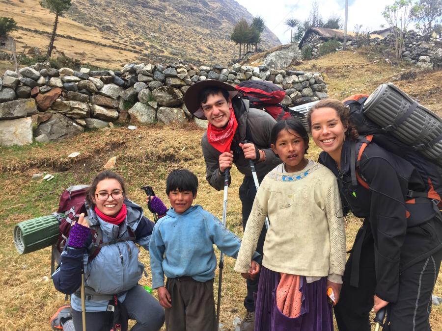
The locals
Throughout the padayatra we met a few local villagers who were friendly but reserved. We did not get a chance to meet most of them, however, because during the day the villagers are out working on their fields or herding their animals. We did see a lot of children to whom we gave prasadam (homemade granola bars and cookies). We were also able to meet a few villagers who were walking along the road going to La Paz, they gave us a friendly greeting and we doubled-checked with them if we were still on the right road. Our team did meet some tourists from France and Germany who were also walking along the same path. They asked us what we were doing and we explained the concept of padayatra, and how it is being done all over the world. This interested them very much. Some of them had, had contact with devotees before and others not so much. We took the opportunity to explain to them briefly about why we are vegetarian and also about reincarnation and the process of bhakti yoga.
In total we walked 52 kilometres over a period of three days. Our padayatra started off at an elevation of 4900 meters above sea level and ended at1200 meters above sea level. We were unable to distribute books or flyers since the 20 kilogram back packs each of us were carrying was filled with tents, sleeping, bags, clothing and prasadam.
The experience
The experience gave me a few realizations. One being, that nature when it is protected allows you to understand how perfect and beautiful Krishna’s creation is. The water we came across was very clean which reminded me of what Krishna says in the Bhagavad-Gita that, he is the taste in water. Lastly, I understood just how many people there are, still out there, who have never come in contact with devotees or with the maha mantra, which is why it is so important to try and reach such places.
[1] The United Nations Educational, Scientific and Cultural Organization
[2] An inn located on the side or edge of a road, path or highway